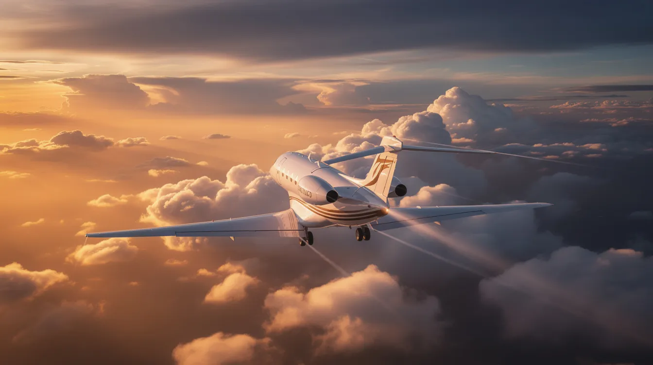
For executives and discerning travelers who measure productivity in minutes, not hours, the jet stream is more than a meteorological curiosity - it is a strategic lever. These fast-flowing rivers of air high in the atmosphere routinely shave 30 to 60 minutes off transatlantic and transcontinental flights, translating directly into earlier arrivals, lower fuel consumption, and fewer hours billed against a Jet Card.
Consider the difference between two of the world's most-traveled private routes. A New York-to-London eastbound flight riding a strong polar jet stream tailwind can arrive in roughly six and a half hours, while the westbound return - fighting the same winds - may stretch past eight. On a Los Angeles-to-New York leg, the gap narrows but remains meaningful: 30 to 45 minutes saved eastbound versus westbound. In rare winter scenarios, unusual wind speed in the jet stream can push jets over 800 mph ground speed, a figure that would seem impossible without nature's invisible tailwind.
Why Jet Streams Matter for BlackJet Members
Here is why this matters for BlackJet members:
Time recaptured: Arriving an hour early for a morning meeting in Zurich or a dinner in Manhattan compounds across dozens of annual trips.
Fuel efficiency: Tailwinds reduce fuel burn per nautical mile, lowering both cost and emissions.
Comfort optimization: Dispatchers who understand jet stream structure route flights to minimize turbulence while capturing favorable winds.
Dynamic scheduling: BlackJet's flight planning teams can adjust departure windows to align with the strongest tailwind corridors.
Altitude advantage: Private jets cruising at FL430–FL510 access jet cores that commercial aircraft at FL330–FL390 often cannot, and different types of private jets leverage these higher cruising levels in distinct ways.
Example scenario: A BlackJet member departs Teterboro at 7 p.m. in January for London Luton. Dispatch identifies a 180-knot polar jet core crossing the mid-Atlantic at FL410. The crew intercepts it over Nova Scotia, and the aircraft touches down 50 minutes ahead of the no-wind estimate - an example of how jet card cost and value are directly influenced by smart use of high-altitude winds.
What Is a Jet Stream?
Think of a jet stream as a fast-moving river of air high above the earth's surface - a narrow, powerful current winding through the upper atmosphere at altitudes where private jets cruise. Jet streams separate colder air from warmer air in the atmosphere, forming along boundaries where two air masses of different temperatures collide.
Jet streams typically exist at altitudes of 30,000 to 45,000 feet - or about 9,100 meters - placing them squarely within private jet cruising levels.
Winds in these relatively narrow bands blow predominantly from west to east, meandering around the globe rather than following straight lines.
Jet streams can reach speeds over 275 mph (442 km/h), with minimums around 60 knots and typical values of 120–200 knots. In strong winter systems, speeds exceed 250–300 knots.
Jet streams meander in wave-like patterns rather than flowing in straight lines, creating ridges and troughs that steer weather systems across continents.
Two types dominate aviation planning: the polar jet stream, found near 50°–60° latitude, and the subtropical jet, positioned around 30° latitude.
The fundamental drivers are Earth's rotation and the temperature contrast between the equator and the poles.
Why Jet Streams Move from West to East
The jet stream's westerly winds are a direct consequence of physics. Air rising near the equator and moving poleward retains the higher eastward rotational speed it had at lower latitudes. As it travels toward the poles - where the surface rotates more slowly - the Coriolis effect deflects this air to the right in the northern hemisphere (and to the left in the southern hemisphere), organizing it into powerful west-to-east currents.
The sharpest temperature gradient - the zone where cold polar air meets warm air from the mid latitudes - concentrates this energy into narrow bands of extreme wind speed. Imagine a vertical cross-section through the atmosphere: wind speed increases steadily with altitude, peaking at the jet core near the tropopause, then tapering above and below. The strongest horizontal and vertical shear zones sit at the edges of this core, which is why turbulence clusters there.
For flying, the implications are immediate:
Eastbound flights gain a powerful tailwind, boosting ground speed and cutting flight time.
Westbound flights may face headwinds exceeding 150 knots, forcing dispatchers to plan routes north or south of the core, or to select altitudes above or below it.
The temperature difference between the equator and poles is not static - it shifts with seasons, climate cycles, and weather patterns - meaning the jet stream moves constantly, demanding real-time monitoring.
Types of Jet Streams
Several distinct jet streams circle the globe, each tied to specific latitude bands, altitude ranges, and seasonal rhythms. Understanding which one affects your route is central to strategic flight planning.
Polar jet stream: Located between 50°–60° latitude, where cold polar air masses meet mid-latitude air. It sits at roughly 30,000–35,000 ft (250–300 hPa) and is strongest during winter months in both hemispheres, when temperature gradients are steepest. Jet streams can reach speeds over 200 mph, especially in winter along this band.
Subtropical jet streams: Found near 30° latitude at higher altitudes - around 39,000–41,000 ft (200 hPa). The subtropical jet forms at the poleward edge of the Hadley cell and tends to be more stable through the seasons, though it still influences routing on flights between North America and the Caribbean, Mediterranean, or the Middle East.
Polar night jet: A strong wintertime current in the stratosphere above 60° latitude, well above typical cruising levels. It plays a crucial role in ozone dynamics and polar climate, but rarely affects private jet range or routing directly.
Jet streams also exist in the southern hemisphere, affecting flights between South America, Africa, and Australasia. Their seasonal shifts change optimal flight paths between continents throughout the year.
How These Jet Streams Influence Weather on Key Business Routes
The polar jet steers North Atlantic storm tracks, which means winter flights between North America and Europe frequently encounter strong winds, clouds, and shifting turbulence zones. Storms generally form where cold and warm air meet at the jet stream boundary, making corridor selection critical.
A ridge in the jet stream can bring high-pressure systems and warmer conditions - pleasant weather but potentially weaker tailwinds on eastbound legs.
A trough in the jet stream can bring low-pressure systems and rainy weather, intensifying turbulence but sometimes offering stronger tailwind corridors nearby.
Winter New York–Zurich: Dispatch may route slightly north to catch a transatlantic jet core, accepting a minor detour for a 45-minute arrival advantage. Summer Dallas–Los Cabos: The subtropical jet's upper-level disturbances may produce turbulence at certain altitudes; the crew selects a cruise level just below the core for a smoother ride across the Pacific Ocean region.
BlackJet's operations team monitors these patterns continuously, adjusting departure times, altitudes, and contingency plans so Jet Card travelers stay on schedule.
How Jet Streams Form and Change Through the Seasons
Jet streams arise wherever strong horizontal temperature gradients exist - most prominently along polar fronts. The general circulation of the atmosphere, driven by large-scale convection cells (Hadley, Ferrel, and polar cells), transports energy and heat from the equator toward the poles. Where these cells meet, sharp thermal boundaries create the conditions for jets to form.
Winter and Summer Jet Stream Behavior
Winter: Stronger temperature differences between tropics and poles intensify the polar jet, making it faster and often shifting it equatorward. This is when jet stream winds most benefit eastbound flights, and most penalize westbound ones. Jet streams are strongest during the winter months in both hemispheres.
Summer: Temperature contrasts weaken, the polar jet shifts poleward and slows, and upper levels are generally calmer across the mid latitudes.
El Niño and La Niña Effects
El Niño: El Niño events shift the jet stream southward, increasing Gulf Coast precipitation and altering storm tracks over North America.
La Niña: La Niña often pushes the jet north, drying the south and soaking the Pacific Northwest.
Jet streams influence seasonal weather patterns by shifting position based on temperature, which means a flight plan optimized for January may look very different in July. They regulate global climate by transporting heat from the equator to the poles, and they help steer low-pressure systems across the planet - affecting everything from landing weather to en-route turbulence. For travelers concerned about overall risk, understanding that private jets are highly safe provides context for how routinely crews work with these powerful atmospheric currents. Jet streams separate regions of high and low pressure, guiding the form and movement of weather systems that affect departure and arrival airports around the world.
Longer-Term Changes, El Niño, and Jet Streams
Climate data reveals that the northern jet stream moved northward at 2.01 kilometers per year since 1979, a trend driven by Arctic amplification - the Arctic warming faster than the mid latitudes, which reduces the temperature gradient that powers the jets.
A weaker gradient can mean a slower, more wavy polar jet with deeper troughs and ridges. When jet streams become stationary in these amplified patterns, they can cause prolonged heatwaves or floods. If jet streams stall, they can lead to prolonged weather events such as heatwaves or heavy rainfall - a pattern observed during European heatwaves and North American cold outbreaks in recent years.
Scientific debate continues about the magnitude and permanence of these shifts. For private aviation, the practical takeaway is that seasonal flight planning becomes less predictable, and real-time route optimization - the kind embedded in BlackJet's operations - grows more valuable with each passing year.
How Jet Streams Affect Flight Time, Fuel, and Comfort
Commercial use of the jet stream began on November 18, 1952, when a Pan Am flight from Tokyo to Honolulu rode the jet for a record crossing. Today, every dispatcher in aviation uses the same principle daily.
Flying with the jet stream can save about 30 minutes across North America on a single eastbound leg; on transatlantic routes, the savings can reach 60–90 minutes.
Eastbound Teterboro–London: With a 150-knot tailwind over 1,200 nm of the crossing, ground speed jumps from ~460 knots to ~610 knots, cutting roughly 50 minutes and saving an estimated 8–12% in fuel.
Westbound London–Teterboro: The crew routes south of the jet core or climbs above it, accepting a longer track to avoid 150+ knot headwinds. A flight time calculator helps members estimate the difference.
On the cold air side of the stream, engine thermodynamic efficiency improves slightly due to lower ambient temperature, modestly benefiting fuel burn.
Temperature increases at lower latitudes can reduce this advantage, making altitude selection a balancing act between wind benefit and engine performance.
BlackJet's 24/7 support allows more dynamic departure timing within client preferences, so members can align with favorable jet stream conditions without being locked into fixed schedules.
Turbulence and Safety Protocols
Jet streams can cause turbulence due to wind shear effects - particularly clear air turbulence (CAT), which occurs without visible clouds or warning. CAT concentrates along sharp wind speed gradients at the jet's edges and in areas where the stream curves sharply. Research published in Climate Dynamics projects that moderate CAT over the North Atlantic will increase significantly with warming, making proactive avoidance more important than ever.
Modern forecasting tools, including ECMWF probabilistic models, satellite imagery, and water vapor channels, predict CAT zones several hours in advance.
Pilot reports (PIREPs) from other aircraft refine turbulence avoidance in real time.
BlackJet partners exclusively with operators meeting stringent safety certification and crew training standards, ensuring that jet stream-related turbulence is anticipated and managed.
Private jets' climb and descent flexibility allows faster altitude changes to exit turbulent jet core regions than large commercial aircraft, constrained by traffic separation, which is a key factor in how turbulence affects private jets differently from airline flights.
One passenger aboard a private jet benefits from this agility in a way that is simply unavailable on a commercial widebody locked into an ATC-assigned level.
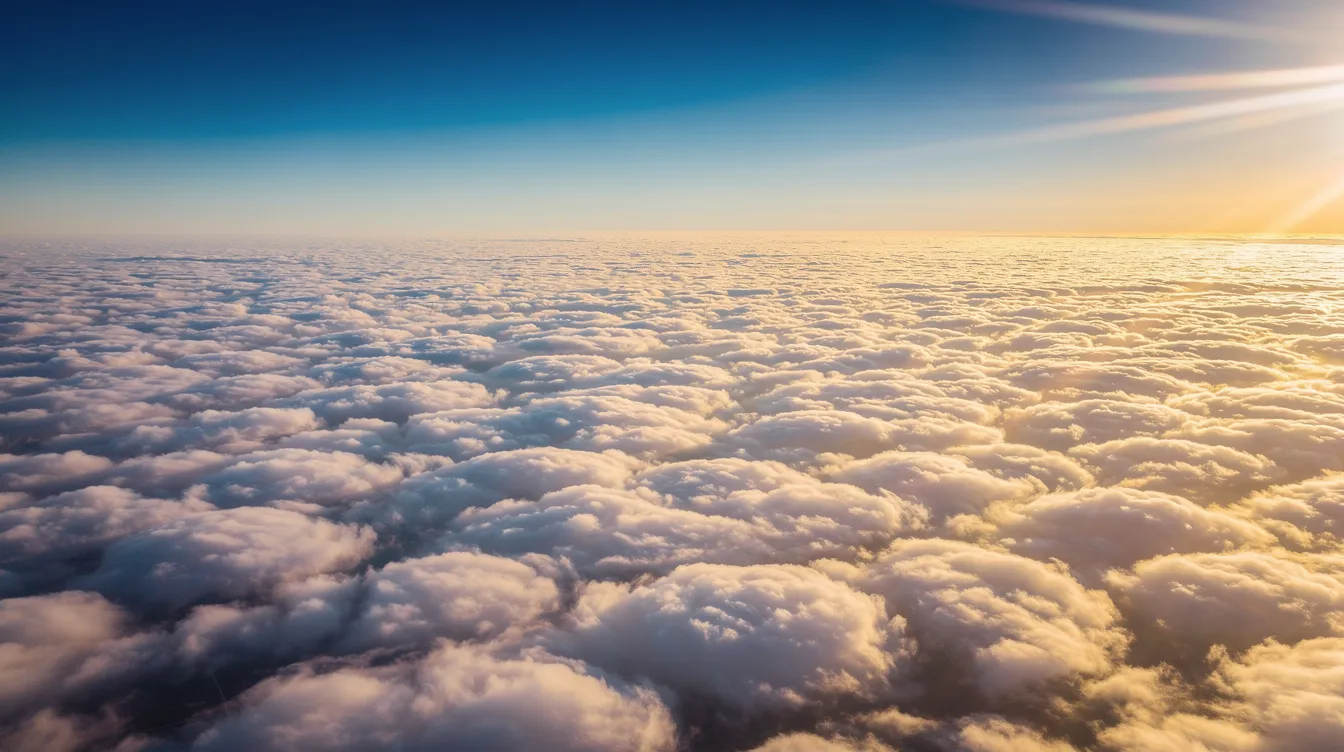
Identifying Jet Streams in Satellite Imagery and Forecast Charts
Satellite images reveal jet streams indirectly - as elongated bands of high cirrus clouds or sharp boundaries between air masses. Water vapor channels and specialized airmass RGB products highlight strong upper-level moisture and temperature gradients that mark the jet's location across the globe.
Aviation dispatchers use upper wind charts at the 250–300 hPa levels, showing core wind speed, direction, and turbulence risk. BlackJet's operations teams read these charts and model outputs continuously to brief crews and advise members on likely flight conditions over any land or ocean crossing, forming a core part of BlackJet's premium private jet service.
Vertical Cross Section of a Jet Stream
Conceptually, a cross-section through a jet stream shows wind speeds increasing toward a central core - often near the tropopause - then decreasing above and below. Temperature gradients tilt with height, and regions of rising and sinking air high on the warm and cold sides of the jet create distinct zones of weather and turbulence.
For aviation, this means:
Light jets cruising at FL350–FL410 may sit below the jet core, experiencing moderate shear.
Large-cabin and ultra-long-range jets at FL430–FL510 can position above it, finding smoother air while still benefiting from residual tailwinds.
BlackJet's preferred cruising levels for different aircraft categories are chosen with these cross-sectional structures in mind, balancing wind advantage against comfort - a calculation that plays out differently on every flight.
Jet Stream Comparison Table
Jet Stream Type | Latitude Range | Altitude (feet) | Typical Speed (mph) | Seasonal Strength | Impact on Flights |
|---|
Polar Jet Stream | 50°–60° | 30,000–35,000 | Over 200 (winter) | Strongest in the winter months | Significant tailwinds eastbound; turbulence zones near edges |
Subtropical Jet Stream | Around 30° | 39,000–41,000 | Variable | More stable year-round | Influences routes between North America and the Caribbean/Mediterranean |
Polar Night Jet | Above 60° | Stratosphere (~80,000) | Very strong (winter) | Winter only | Rarely affects private jet routing |
Jet Streams, Private Jet Strategy, and BlackJet Jet Cards
Access to flexible, on-demand flight time through BlackJet Jet Cards turns jet stream knowledge from academic interest into a practical edge. Here is how it works in practice.
A BlackJet member books a January departure from New York to London on a 25-hour Jet Card. The dispatch team identifies a 180-knot polar jet tailwind crossing the Atlantic at FL410. They timed their departure for 7 p.m. to intercept the strongest corridor, and the aircraft arrived 50 minutes early - enough for a restful night before a morning meeting.
On the westbound return, the same team selects a more southerly track, climbing to FL450, where headwinds weaken from 160 knots to 90. The member notices a slightly longer flight but a smoother ride and no schedule disruption.
Cabin class and aircraft category options - light, midsize, super-midsize, large cabin - allow BlackJet to select jets with optimal range, climb performance, and ceiling to exploit or avoid particular jet levels. For frequent travelers, choosing the best jet card program aligns these aircraft options with predictable access and pricing. All of this is managed behind the scenes by BlackJet's technology platform and operations team. Members simply choose their departure window and destination; the jet stream strategy flows from there.
Sustainability: Jet Streams and Carbon-Neutral Private Flights
Riding strong tailwinds reduces fuel burn per mile - a direct environmental benefit. When combined with modern, fuel-efficient aircraft, this routing intelligence meaningfully lowers total emissions per trip.
BlackJet provides carbon-neutral flights by calculating residual emissions and funding verified offset or insetting projects at no extra cost. Smart use of jet stream routing is one component of a broader sustainability strategy that includes fleet modernization and optimized scheduling. Jet stream-aware flight planning is both a performance and environmental advantage built into the Jet Card model.
Frequently Asked Questions About Jet Streams and Private Flying
What altitude are jet streams at compared with private jet cruising levels?
Jet streams occur around 30,000 feet (9,100 meters) high, extending up to 45,000 feet. Private jets cruise between FL350 and FL510 depending on category, placing them directly within or above jet stream altitudes - a significant advantage over commercial aircraft that typically top out around FL390, especially when flying some of the best long-range private jets in the world.
Why is my eastbound flight often shorter than my westbound flight?
Westerly winds in the jet stream provide tailwinds eastbound and headwinds westbound. The difference can be 30–90 minutes on transatlantic routes and roughly 30 minutes on transcontinental flights.
Do jet streams make flights more dangerous?
Jet streams themselves are not dangerous, but the wind shear at their edges can produce clear air turbulence. Trained crews using modern forecasting and real-time pilot reports manage this risk routinely. Private jets can change altitude more quickly than commercial aircraft, exiting turbulent zones faster.
Can pilots see the jet stream?
Not directly. Pilots rely on forecast charts, satellite images, onboard instruments, and reports from other aircraft. Elongated cloud bands visible from the cockpit can hint at jet stream location, but are not reliable indicators on their own.
Does flying in a jet stream change my Jet Card hours used?
Jet Card hours are billed on actual flight time. A strong tailwind that shortens your flight means fewer hours consumed relative to the distance traveled - a tangible benefit of how Jet Cards work and how jet card cost per hour can be optimized when winds aloft are working in your favor.
Could jet streams ever be used as an energy source?
Theoretically, jet streams could generate 1,700 terawatts of power, and only 1% of jet stream energy could meet global energy needs. However, another estimate suggests jet streams can generate only 7.5 terawatts when accounting for atmospheric feedback. Technology to harness jet stream energy may take 10–20 years to develop, and no commercial system exists today.
How are jet streams changing with climate?
The polar jet stream is located between 5 ° and 60° latitude but has been gradually shifting poleward. Arctic warming weakens the temperature gradient that drives these flows, potentially increasing waviness, blocking patterns, and associated extreme weather.
Elevate Your Travel with Jet Stream–Smart Private Jet Access
Jet streams are among the most powerful forces in the atmosphere - invisible rivers that shape weather across the globe, steer storms and seasons, and determine whether your flight lands early or late. For private jet travelers, they represent an opportunity that only flexible, expertly managed aviation can fully capture.
BlackJet leverages real-time jet stream forecasts, satellite imagery, and advanced flight planning tools to optimize every trip for time, comfort, and sustainability. Jet Card membership delivers this level of optimization consistently - without the overhead of ownership or the unpredictability of ad-hoc charter.
Elevate your travel - effortlessly. Explore BlackJet's Jet Card programs and understand jet card pricing structures to see how strategically planned, carbon-neutral flights can transform your global schedule. When the jet stream is working for you, every hour in the air becomes an advantage on the ground.


 Sign up with google
 Sign up with Apple